Brisbane bikeways
Explore Brisbane’s bikeways and plan your next ride. Find details on popular local riding routes and report bikeway issues.

Bike paths map
Plan your ride and view individual cycle lane details using our interactive Community Maps application.
The map shows the locations of Council bikeways across Brisbane.
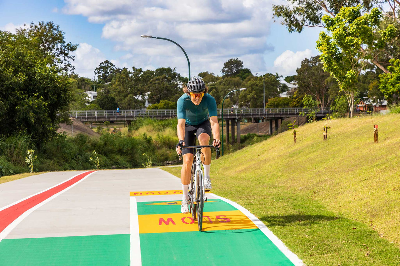
Popular bikeways
Brisbane has a wide variety of bikeways to explore.
Whether you’re commuting, exercising or sightseeing, they’re a great way to get around while enjoying our outdoor lifestyle.
This off-road 4.8 km pathway runs along the Brisbane River from Toowong to the Brisbane CBD. Featuring separate bike and pedestrian paths, it’s ideal for walking, riding and scooting by people of all ages and abilities.
At the CBD, connect to other pathways that lead to South Bank, Kangaroo Point and New Farm.
About 4 km long, this ride starts at the Boondall Wetlands Environment Centre and leads to Nudgee Road. The flat route offers views of marshlands, woodlands and mangroves. You might also spot native wildlife on your scenic ride.
This picturesque off-road shared path runs for about 20 km from Murarrie to Eight Mile Plains. The relatively flat path has many shady sections as it travels alongside Bulimba Creek through parks and open fields.
Download the Bulimba Creek Bikeway map.
This paved, shared-use pathway connects Ashgrove, Red Hill and Newmarket to the northern suburbs of Windsor and Herston. Generally flat, it’s perfect for families, and you’ll find many green spaces along the way, including Spencer Park, Finsbury Park and Downey Park.
Download Ithaca Creek and Enoggera Creek Bikeways map.
Running from Mitchelton to Nundah, Kedron Brook Bikeway is almost 20 km long and a mix of separated bikeways and off-road shared pathways.
Break up your ride at the picnic areas, barbecue facilities and parks along the way. You can use this route to get to local schools, sports clubs, shops and train stations.
At Nundah the bikeway becomes the Jim Soorley Bikeway which allows you to connect to Nudgee Beach and the Boondall Wetlands Bikeway.
Download the Kedron Brook Bikeway map.
An important cycle corridor for the greater Brisbane area, the North Brisbane Bikeway connects the northern suburbs to Brisbane CBD. From this bikeway you can access Ithaca Creek, Enoggera Creek or Kedron Brook Bikeways.
The 7.5 km route includes 4.5 km of separated paths. For more information on this route, visit the Department of Transport and Main Roads.
A dedicated 3-metre-wide bikeway for bikes and e-mobility devices that runs from South Brisbane to Slacks Creek. The V1 is popular with commuters, connecting to Brisbane CBD via the Goodwill Bridge.
For more information, including a virtual tour, visit the Department of Transport and Main Roads.
This bikeway leads into the Centenary Cycleway, providing a dedicated connection from Toowong to Ellen Grove.
Popular with commuters, this connects to the Bicentennial Bikeway at Toowong. If you’re riding for leisure, you can stop by several parks or shops along the way.
Report bikeway maintenance issues
It’s important to report damage or blockages on Brisbane bike paths so we can keep them safe for everyone.
You can report issues such as uneven or cracked surfaces, overgrown trees or lighting in need of repair.

Helpful links

Frequently asked questions
Some of Brisbane's bikeways might not be open due to flood damage, maintenance, repairs or upgrades.
To find out which bikeways may be affected, check the bikeway closures and detours.
The Bulimba Creek Bikeway is the longest bike path in Brisbane. This bikeway stretches from Murarrie to Eight Mile Plains.
Learn more about the Bulimba Creek bikeway and other popular Brisbane bikeways.