
Beams Road upgrade (Lacey Road to Handford Road) - Carseldine, Fitzgibbon, Taigum, Zillmere
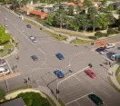
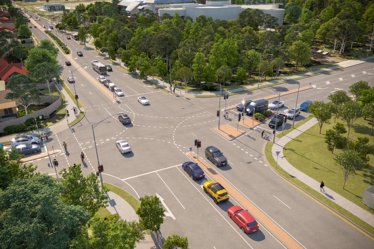
Artist impression of the Dorville Road intersection
The Beams Road upgrade will deliver important safety improvements for all road users, reduce traffic congestion and improve travel time and reliability. The project will also make it easier for people walking and riding to access local shops and nearby amenities.
Current construction impacts
- Beams Road is reduced to one lane in each direction between Lacey Road and Balcara Avenue from Monday 27 November 2023. Please allow additional travel time.
- Beams Road at Carseldine Campus bus stop (ID: 003366) has been temporarily relocated west of the Dorville Road and Beams Road intersection. Find out more in construction updates.
- Changed traffic conditions and detours in place. Please follow directional signage.
Project summary
Address
Beams Road, between Lacey Road and Balcara Avenue, Carseldine
Ward
bracken ridge
Project objectives
Improve safety, reduce congestion and improve travel time reliability
About the project
Beams Road is an important link connecting communities and providing a commuter corridor to major arterial roads such as Gympie Road. Beams Road carries approximately 19,000 vehicles each day and is set to get busier with significant growth forecast in the Carseldine, Fitzgibbon, Taigum and Zillmere areas.
The Beams Road upgrade (Lacey Road to Handford Road), will help ease congestion now and plan for future growth.
The Beams Road upgrade is jointly funded by the Australian Government for $50 million, and by Brisbane City Council under the Better Roads for Brisbane Program.
Project fly-through video
You can also watch this video on Council's YouTube Channel.
Video supporting information
The fly-through video shows an aerial view of the Carseldine, Fitzgibbon, Taigum and Zillmere area with animations highlighting these suburbs. A red pinpoint is pointing towards Beams Road with white labels highlighting Gympie Road, Lacey Road, Cowie Road, Dorville Road and Handford Road. The fly-through then shows an animation of labels appearing above key landmarks, highlighting Carseldine Central, Carseldine Market, Carseldine Village, Carseldine Station, Holy Spirit College, Cabbage Tree Creek and St Flannan’s School.
The fly-through transitions from an aerial perspective to an east facing perspective above the Handford Road and Beams Road intersection. The fly-through moves from Handford Road west along Beams Road and transitions to a north-west facing perspective above the Cabbage Tree Creek shared path underpass. A yellow animated line travels along the Cabbage Tree Creek shared path and through the underpass before connecting back on to Beams Road in front of the Holy Spirit College.
The fly-through continues west along Beams Road towards Golden Place and Carselgrove Avenue. An animation of a grey rectangle indicating the Queensland Government Rail Level-Crossing Project starts from Golden Place and Carselgrove Avenue and finishes at the intersection of Plaza Place and Balcara Avenue.
The video then continues travelling west on Beams Road towards the Dorville Road and Beams Road intersection and the Cowie Road and Beams Road intersection. The fly-through continues travelling west on Beams Road towards the Lacey Road and Beams Road intersection. The video then fades out at the end of the project zone.
Summary of construction
Main construction works along Beams Road, between Cowie Road and Balcara Avenue, commenced in late September 2023.
The following is a summary of the works being undertaken as part of the project.
- Upgrading the Dorville Road intersection, by removing the existing roundabout and installing traffic signals and signalised pedestrian crossings.
- Widening the roadway between Cowie Road and Balcara Avenue.
- Constructing a new shared path for people walking and riding from Lacey Road to Balcara Avenue.
- Upgrading power and communications services by public utility authorities (Energex, Telstra, NBN and other communications) from Lacey Road to Balcara Avenue.
We encourage anyone who lives, works or travels along Beams Road to subscribe to receive regular email updates as the project progresses and check construction updates.
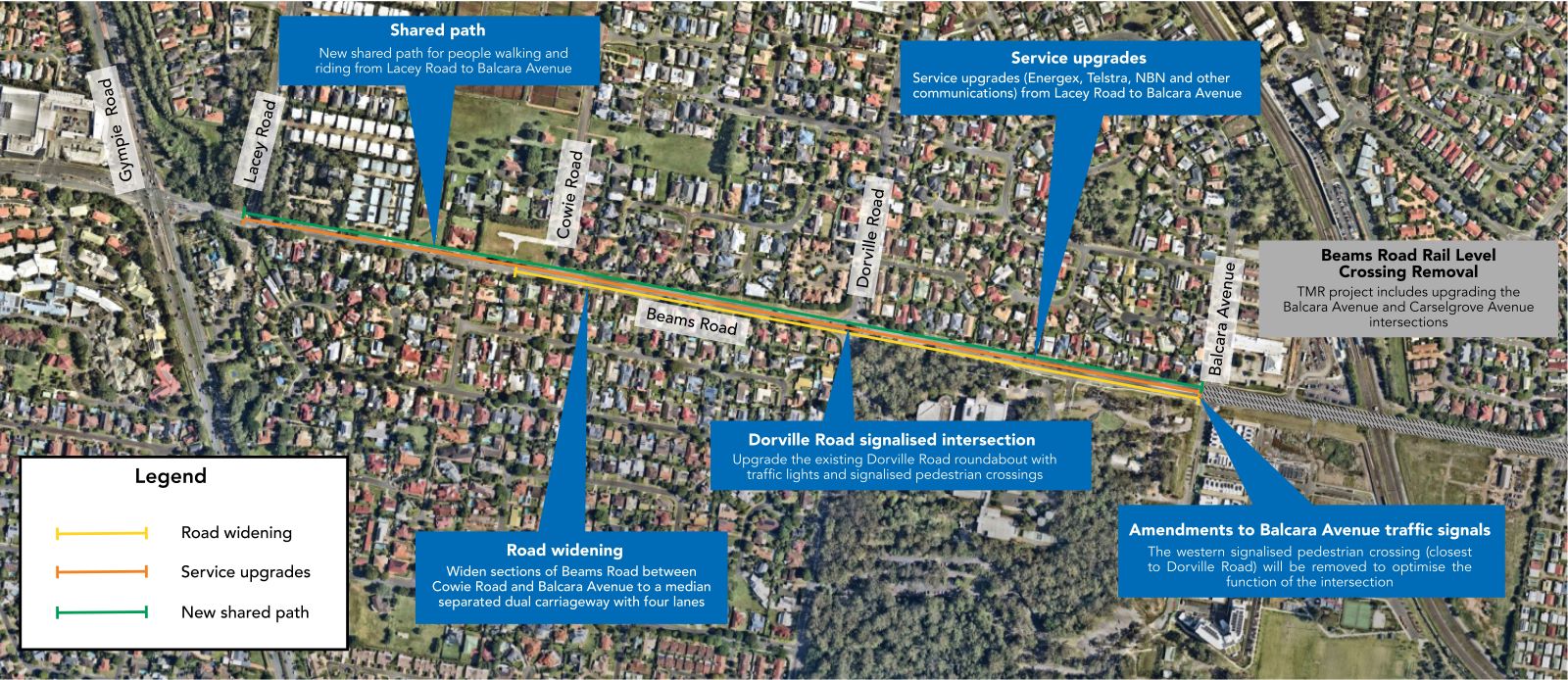
Map of Beams Road upgrade – Lacey Road to Balcara Avenue
Supporting information
The map displayed shows an aerial view of Beams Road in Carseldine, with three coloured lines running west to east along Beams Road between Lacey Road and Balcara Avenue, and six text boxes pointing to various sections along Beams Road.
The green line indicates where a new shared path, with a blue text box that reads new shared path for people walking and riding will be constructed from Lacey Road to Balcara Avenue. Upgrades to local services are indicated by an orange line and a blue textbox that reads service upgrades (Engergex, Telstra, NBN and other communications) will be undertaken from Lacey Road to Balcara Avenue. A yellow line running along Beams Road between Cowie Road and Balcara Avenue indicates road widening, with a blue text box that reads sections of Beams Road between Cowie Road and Balcara Avenue will be widened to a median separated dual carriageway with four lanes.
A text box pointing to the Dorville Road and Beams Road intersection advises that an upgrade to the existing Dorville Road roundabout will occur and the roundabout will be replaced with traffic lights and signalised pedestrian crossings. A text box pointing to the Balcara Avenue and Beams Road intersection reads amendments to Balcara Avenue traffic signals, the western signalised pedestrian crossing (closest to Dorville Road) will be removed to optimise the function of the intersection.
A grey text box on the eastern side of the map points to a railway line, running north to south. This text box labels the Beams Road Rail Level Crossing Removal site, a TMR project, which includes upgrading the Balcara Avenue and Carselgrove Avenue intersections.
View a detailed project plan from Lacey Road to Balcara Avenue.
Improve safety for all road users.
Reduce traffic congestion.
Improve Travel time and reliability.
Improve connectivity for people walking and riding.
Project stages
During future stages of the project, the following works will be undertaken.
- Widening the roadway from Carselgrove Avenue to Handford Road.
- Installing a new shared path for people walking and riding from Carselgrove Avenue to Handford Road.
- Constructing a new shared pedestrian underpass at Cabbage Tree Creek.
We will share more information as these works are programmed.
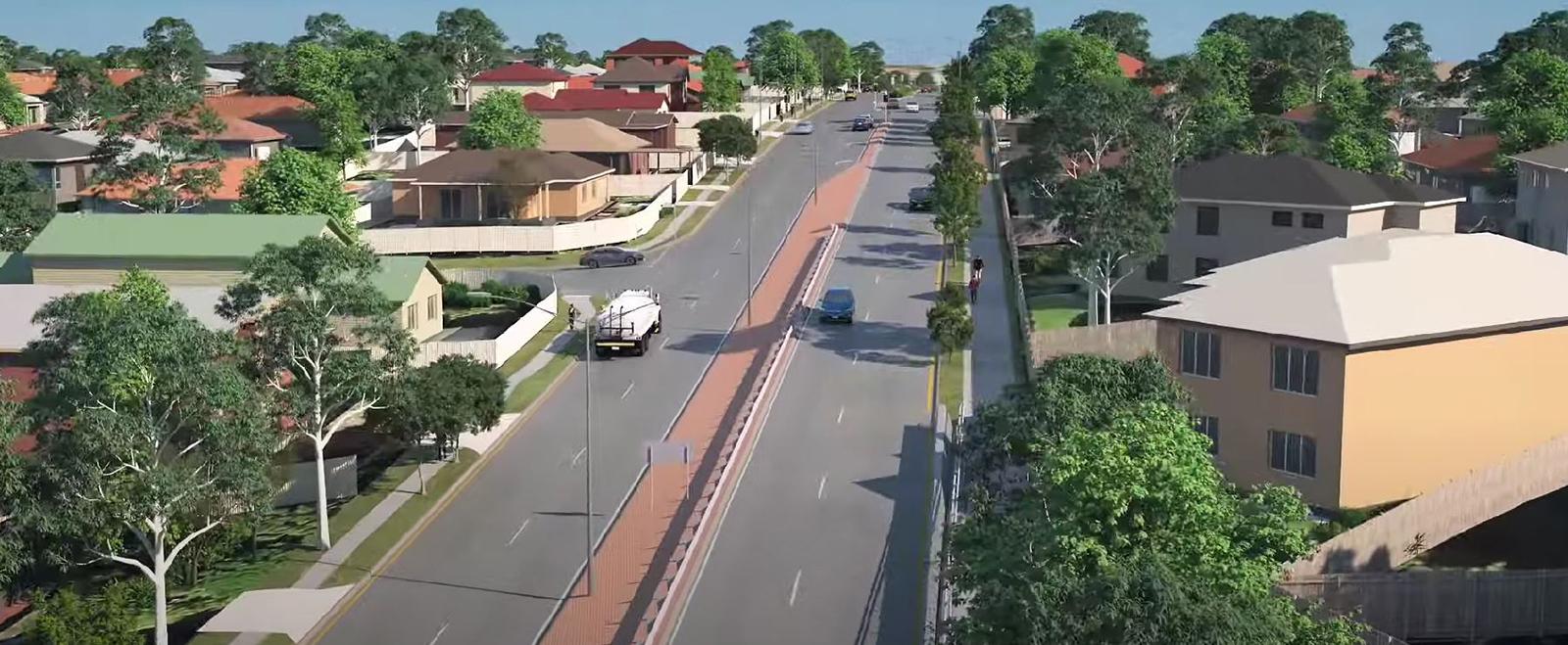
Project features
The Beams Road upgrade (Lacey Road to Handford Road) project design includes key features to deliver safety improvements and to reduce congestion along the corridor. The following is a summary of the key project features.
- Increasing sections of Beams Road from two lanes to four lanes to create a consistent four-lane corridor.
- Installing new traffic lights at the Dorville Road intersection with signalised pedestrian crossings.
- Widening the culverts and constructing a new shared path underpass at Cabbage Tree Creek.
- Upgrading the traffic lights at the intersection with Handford Road to provide dedicated left-turn lanes.
- Installing new pedestrian-activated signalised crossings throughout the corridor to improve connectivity and safety for people walking and riding.
- Installing new traffic lights at the intersection with Cowie Road to improve safety for all road users.
- Installing two new U-turn facilities at the Cowie Road intersection.
- Upgrading and installing new shared paths throughout the corridor to improve connectivity and safety for people walking and riding.
- Including wide kerbside lanes throughout the corridor for active transport users.
Pagination
Newsletters and notices
Newsletters and notices
- Beams Road upgrade (Lacey Road to Dorville Road - works notice - September 2023 (PDF 49.23kb)
- Beams Road upgrade (Lacey Road to Dorville Road - works notice - September 2023 (Word 157.17kb)
- Beams Road upgrade (Lacey Road to Handford Road) - project update newsletter - August 2023 (PDF - 426kb)
- Beams Road upgrade (Lacey Road to Handford Road) - project update newsletter - August 2023 (Word - 176.29kb)
- Beams Road upgrade (Lacey Road to Handford Road) - project update newsletter - April 2023 (PDF - 2.48Mb)
- Beams Road upgrade (Lacey Road to Handford Road) - project update newsletter - April 2023 (Word - 3.35Mb)
- Beams Road upgrade (Lacey Road to Handford Road) – Detailed design newsletter – May 2022 (PDF - 2.95Mb)
- Beams Road upgrade (Lacey Road to Handford Road) – Detailed design newsletter – May 2022 (Word - 1.17Mb)
- Beams Road upgrade (Lacey Road to Handford Road) – Project update newsletter – April 2022 (PDF - 1.56Mb)
- Beams Road upgrade (Lacey Road to Handford Road) – Project update newsletter – April 2022 (Word - 1.22Mb)
- Beams Road upgrade (Lacey Road to Handford Road) – Project preliminary design newsletter – September 2021 (PDF - 1.17Mb)
- Beams Road upgrade (Lacey Road to Handford Road) – Project preliminary design newsletter – September 2021 (Word - 2.01Mb)
Project plan
Project plan
- Beams Road upgrade (Lacey Road to Balcara Avenue) - project plan - August 2023 (PDF - 3.93Mb)
- Beams Road upgrade (Lacey Road to Balcara Avenue) - project plan - August 2023(Word - 1.33Mb)
- Beams Road upgrade (Lacey Road to Handford Road) – Project plan - Detailed design – May 2022 (PDF - 6.75Mb)
- Beams Road upgrade (Lacey Road to Handford Road) – Project plan - Detailed design – May 2022 (Word - 1018kb)
- Beams Road upgrade (Lacey Road to Handford Road) – Project plan - Preliminary design – September 2021 (PDF - 754kb)
- Beams Road upgrade (Lacey Road to Handford Road) – Project plan - Preliminary design – September 2021 (Word - 3.77Mb)
Artist impressions for the project
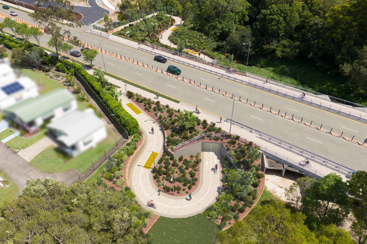
Cabbage Tree Creek shared path underpass artist impression
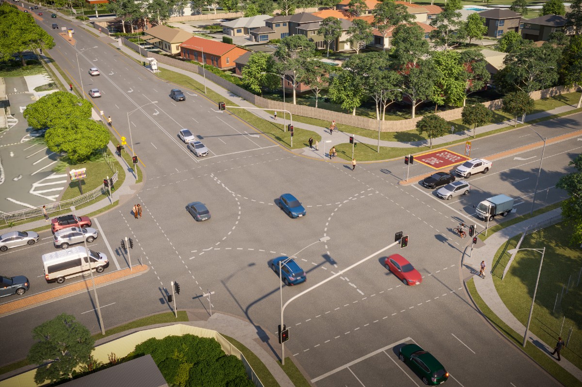
Dorville Road intersection artist impression
Handford Road intersection artist impression
More information
To find out more about this project, you can:
- phone the project team on 1800 870 437 (8.30am to 4.30pm, Monday to Friday)
- phone Council’s 24-hour Contact Centre on 07 3403 8888 outside of business hours
- email the project team
- use the online contact form to register for future project updates
- write to:
Beams Road upgrade
City Projects Office
Brisbane City Council
GPO Box 1434
Brisbane Qld 4001.