Tinchi Tamba Wetlands
Go fishing, boating and canoeing at Tinchi Tamba Wetlands. Use the trail map to explore the wetlands and reserve.
About Tinchi Tamba Wetlands
Tinchi Tamba Wetlands covers more than 380 hectares. The wetlands are part of a network of coastal wetlands on the edge of Moreton Bay.
The wetlands are made up of tidal flats, mangroves, open forest and other habitats that support marine animals and birdlife.
Explore the area by land or water, on walking tracks and canoe trails. You’ll also find a playground, boat ramp, fishing platform and picnic facilities.
Getting there
Tinchi Tamba Wetlands
Travel options
Access the wetlands from Wyampa Road, Bald Hills.
You’ll find 3 car parks along Wyampa Road, including one for boat trailers.
Plan your trip with Translink’s Journey Planner.
Plan your ride using our bike paths map.
Plan your visit
Spend a full day exploring and relaxing in nature.
Set up at Deep Water Bend, where you can picnic by the Pine River and the playground. Fresh water, barbecues and toilets are located at the picnic area.
Launch your boat, canoe or kayak into the Pine River from the nearby boat ramp. You can also cast off from the fishing platform.
As day turns into night, watch the sun set over the silhouette of the D’Aguilar Range.
Help preserve natural areas and keep safe when visiting the wetlands.
-
Keep your dog on a leash.
-
Stay on designated tracks and trails.
-
Don't touch or disturb animals or plants.
-
Dispose of rubbish and dog waste responsibly.
-
Keep a track map, your phone and water on you.
-
Check tides, currents and wind conditions before heading out on the water.
Tinchi Tamba Wetlands has 2 easy walking tracks with mostly flat ground, few obstacles and minor slopes.
A 1-kilometre track takes you through open grasslands to the bird hide. From there, watch the shorebirds that roost on the mudflats.
The 3-kilometre track includes a boardwalk over the saltmarshes on the riverbank and mangroves. The track then loops through the eucalypt and paperback forest.
There are also 2 canoe trails for water enthusiasts. Paddle out into the Pine River or follow the second trail around the wetlands and down Bald Hills Creek.
Download the track map to plan your walk or paddle.
Tinchi Tamba Wetlands provides important habitat for many animals, including:
- the vulnerable dugong
- the endangered green and loggerhead turtles
- migratory shorebirds that visit from as far away as Siberia, Mongolia and Alaska. The shorebirds feed and roost in the wetlands and other areas in the Moreton Bay region, including Boondall Wetlands.
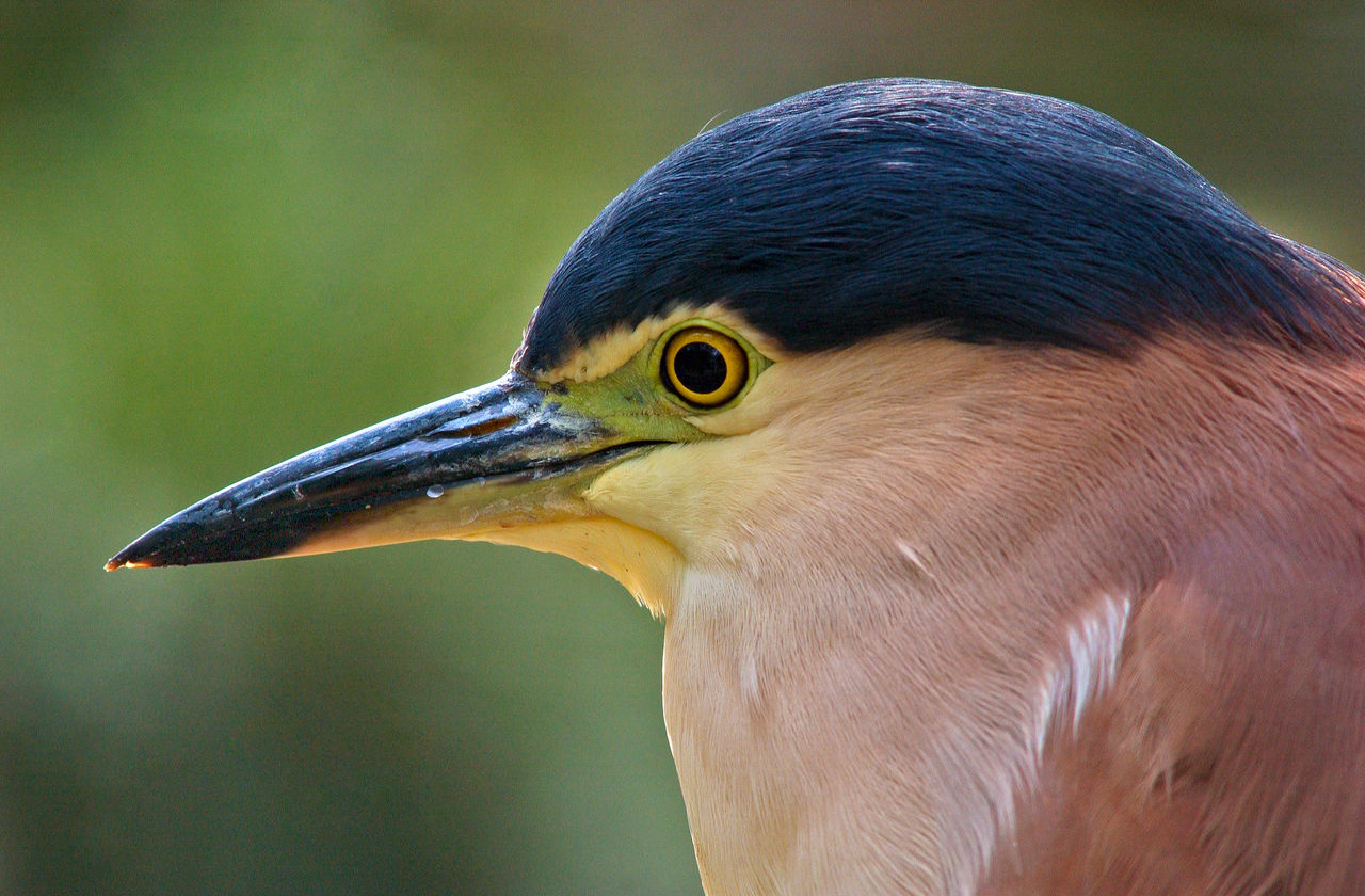
A birdwatcher’s paradise, Tinchi Tamba Wetlands is also home to:
- eastern curlews, sharp-tailed sandpipers and whimbrels
- avocets, royal spoonbills, Pacific herons and Australian white ibis
- pale-headed rosellas, rufous whistlers and brown honeyeaters
- sea eagles, brahminy kites, cormorants, brown quails and golden-headed cisticola
- collared kingfishers, mangrove honeyeaters, striated herons and mangrove gerygones.
Vegetation in the wetlands includes:
- mangroves
- saltmarshes
- grasslands
- intertidal flats
- casuarina forests
- paperbark swamps
- low open shrubland
- dry eucalypt woodlands
- reed and sedge swamp pasture.
Learn how you can play your part to protect local wildlife and plant life.
Yes, you can take your dog to Tinchi Tamba Wetlands. You must keep your dog on a leash and dispose of any waste responsibly.
Want to let your dog run free? Go to the nearby dog park at Gus Davies Park in Bald Hills.
'Tinchi’ means ‘mangrove’ and ‘tamba’ means ‘ibis’ in the language of the local Aboriginal and Torres Strait Islander peoples.
You can ride on the bike path that starts at the Deep Water Bend picnic area in Tinchi Tamba Wetlands. It runs along Wyampa Road towards the Gateway Motorway overpass.
Find out where else you can ride in Brisbane.