Wynnum Heritage Trail
Discover the stories that shaped Wynnum as a premier seaside retreat on this self-guided trail.
About the trail
Explore Wynnum’s rich past on the Wynnum Heritage Trail, which highlights key moments in the area’s history, including:
- its rise as a bayside holiday destination
- the development of Bay Terrace
- the impact of the Great Depression
- the story of Wynnum’s cinemas and entertainment.
Choose your trail
This heritage trail is special. We’ve included an extension to the main trail to showcase the heritage of the foreshore from Wynnum to Manly.
Downloadable trail guide and map
Acknowledgement: Wynnum Manly Historical Society contributed images and background information for this trail.
Main trail
This 4.4-kilometre heritage trail features 18 points of interest.
The route is a loop beginning at the Wynnum Wading Pool Park and ending at the Wynnum Jetty.
Trail map
Points of interest
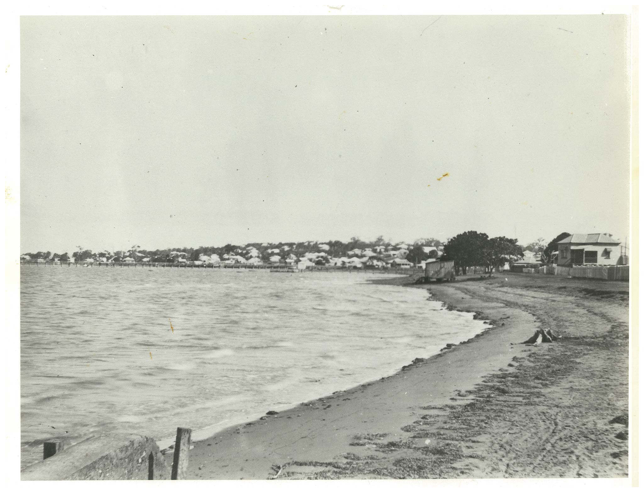
Wynnum Esplanade
Get directions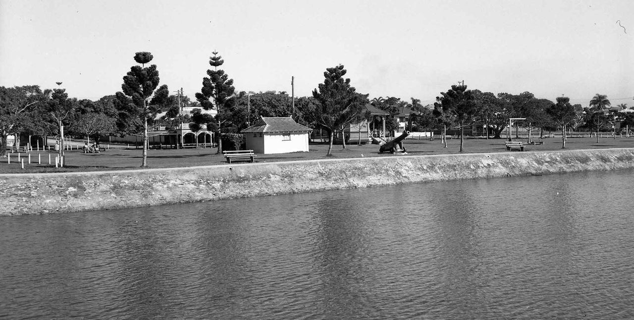
Wynnum foreshore along Wynnum Esplanade, at the corner with Florence Street, 1951 (Brisbane City Archives)
Across the Esplanade once stood the Crown Theatre, which was open by 1914 and had quickly become a major attraction. By 1917, tickets were hard to get, and its location near Florence Street made beach access easy for visitors. The theatre also hosted fundraisers and community events, including a large baby show in 1926. Its popularity faded over time, and it was demolished in 1983.
75 Waterloo Esplanade, Wynnum
Get directions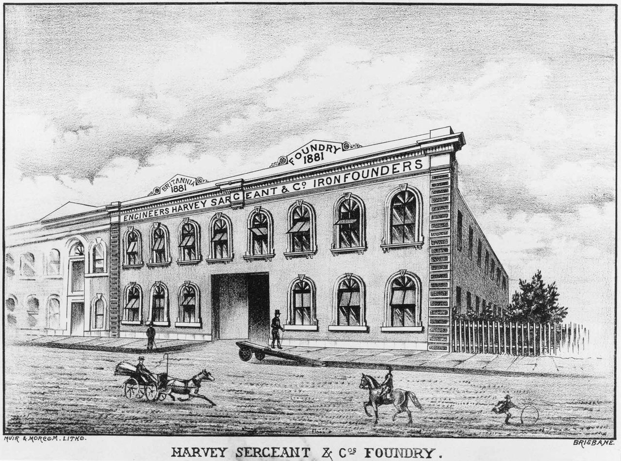
Engineers A. Sargeant & Co., Iron Foundry on Alice Street, c. 1887 (State Library of Queensland)
The family were active community members who contributed to Wynnum’s social and sporting life. Harry served as Commodore, and his son, Henry, as Vice-Commodore of the Wynnum Manly Sailing Club, regularly supporting local races. Henry's wife, Edie, participated in church and swimming groups, helping strengthen community connections. The home remained in the Sargeant family until the late 1970s and continues to be a private residence today.
55 Berrima Street, Wynnum
Get directions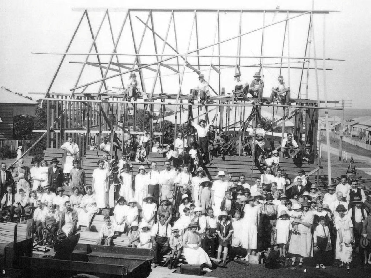
Construction of the Wynnum Church of Christ, 1925 (Wynnum Manly Historical Society)
As attendance grew, land was purchased and plans were quickly approved for a permanent church. On 12 December 1925, more than 60 volunteers worked together to construct most of the building in a single day. The church opened the following week with around 100 members already involved. By 1930, the congregation had expanded again, prompting another volunteer-led extension. The church served Wynnum for almost a century before closing in 2013. It now operates as a centre providing social support services.
75 Berrima Street, Wynnum
Get directions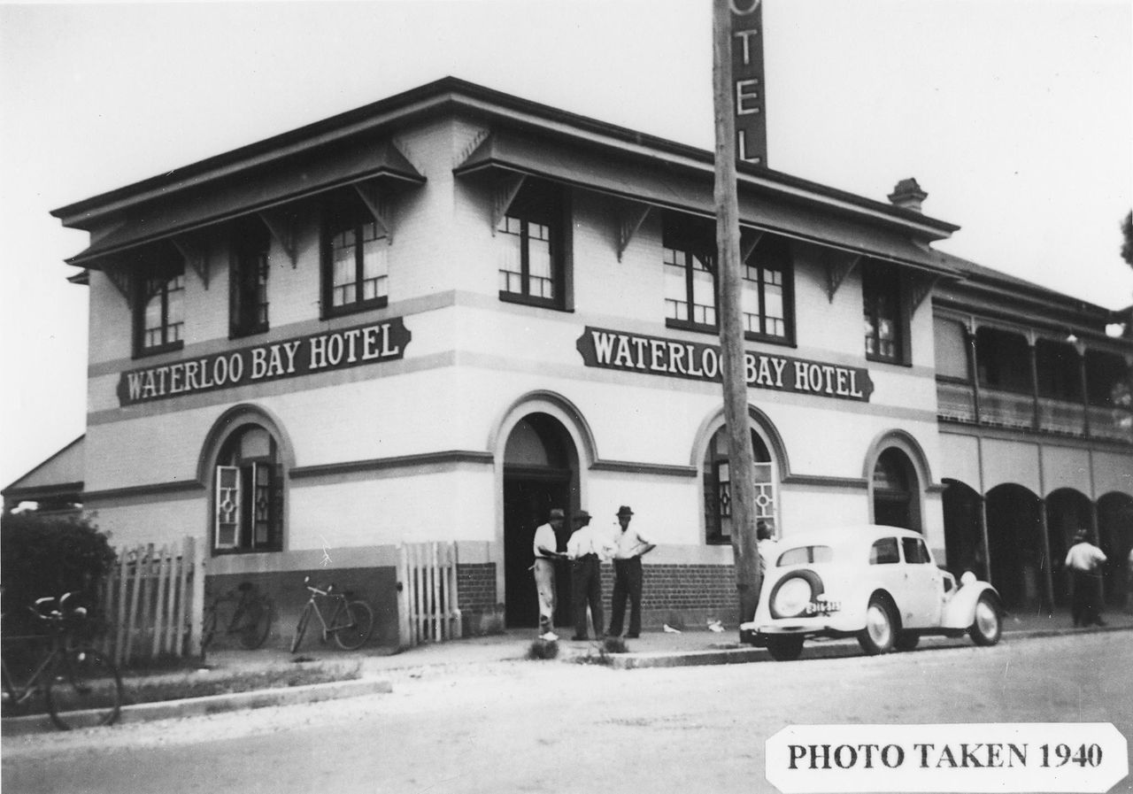
Waterloo Bay Hotel, Wynnum, 1940 (State Library of Queensland)
In 1929, the Brisbane Courier grandly described the hotel as “a credit to the district in every respect”. As Wynnum grew, the hotel remained central to local life, hosting events and providing services to both locals and visitors. Today it continues its long tradition of hospitality and is protected on the Queensland Heritage Register for its cultural significance.
245 Tingal Road, Wynnum
Get directions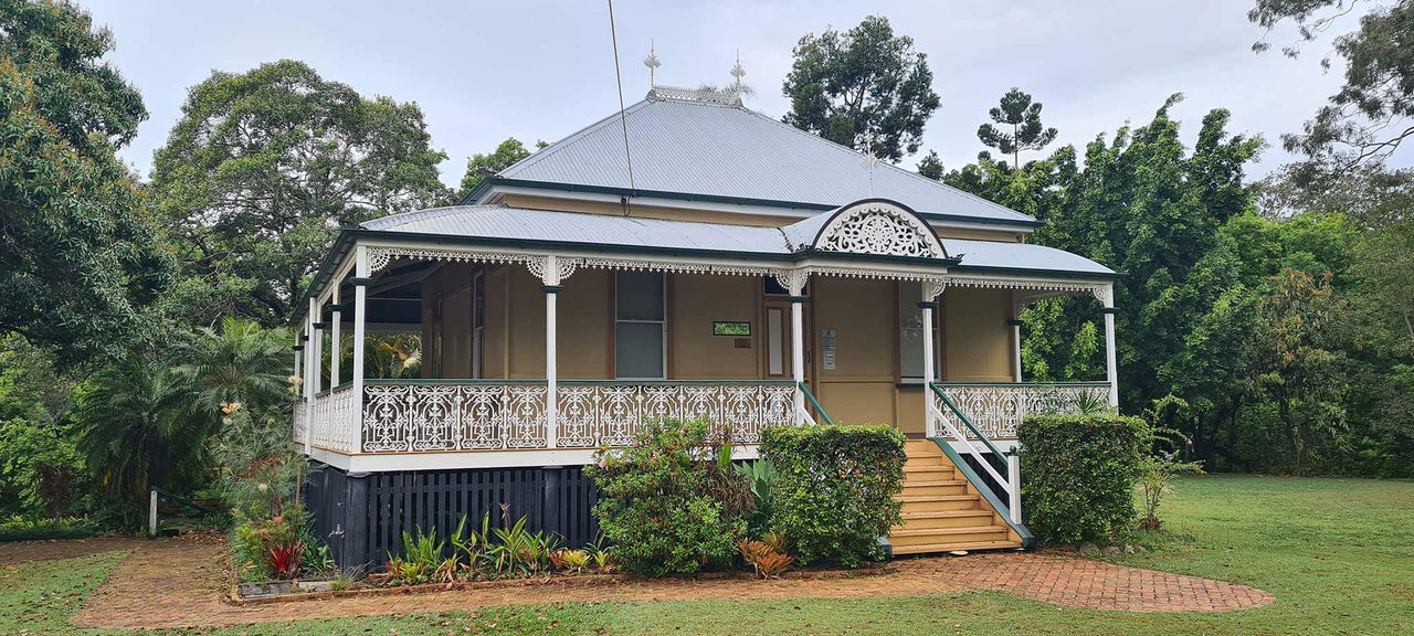
Now: Shire Clerk’s Cottage, 2025
The adjoining hall and offices were central to community administration and hosted official visitors. Over time, the local authority evolved before being absorbed into Brisbane City Council in 1925. The cottage was restored in the 1980s and now forms part of the Waterloo Bay Leisure Centre. Nearby, the Pamphlett Memorial commemorates 3 convicts whose 1823 journey helped guide early exploration of the Brisbane River.
Photos and virtual tour
Take a closer look at the Shire Clerk's Cottage with photos and a virtual tour.
20 Bridge Street, Wynnum
Get directions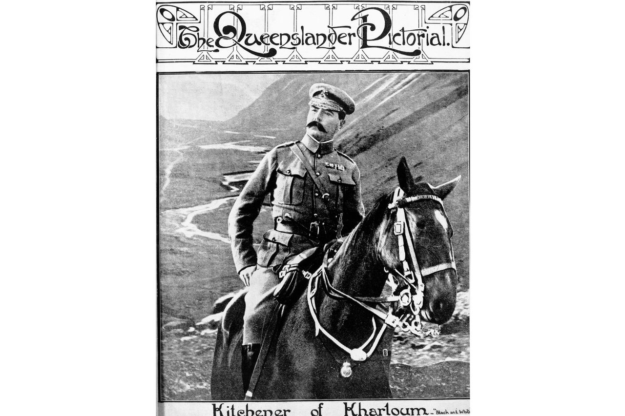
Lord Kitchener pictured on horseback in the Queenslander Pictorial, 1910 (State Library of Queensland)
In the afternoon, 3,000 soldiers saluted him as they marched nearby this site. Wynnum Town Council first commemorated the event with a timber marker, replaced in 1929 with the current granite tablet. The memorial was removed during development in the 1960s but reinstated in the 1990s, slightly south of its original location. In 1926 a large park opened nearby without a name. Locals later requested it be named Kitchener Park, preserving the area’s link to early 20th Century military history.
150 Florence Street, Wynnum
Get directions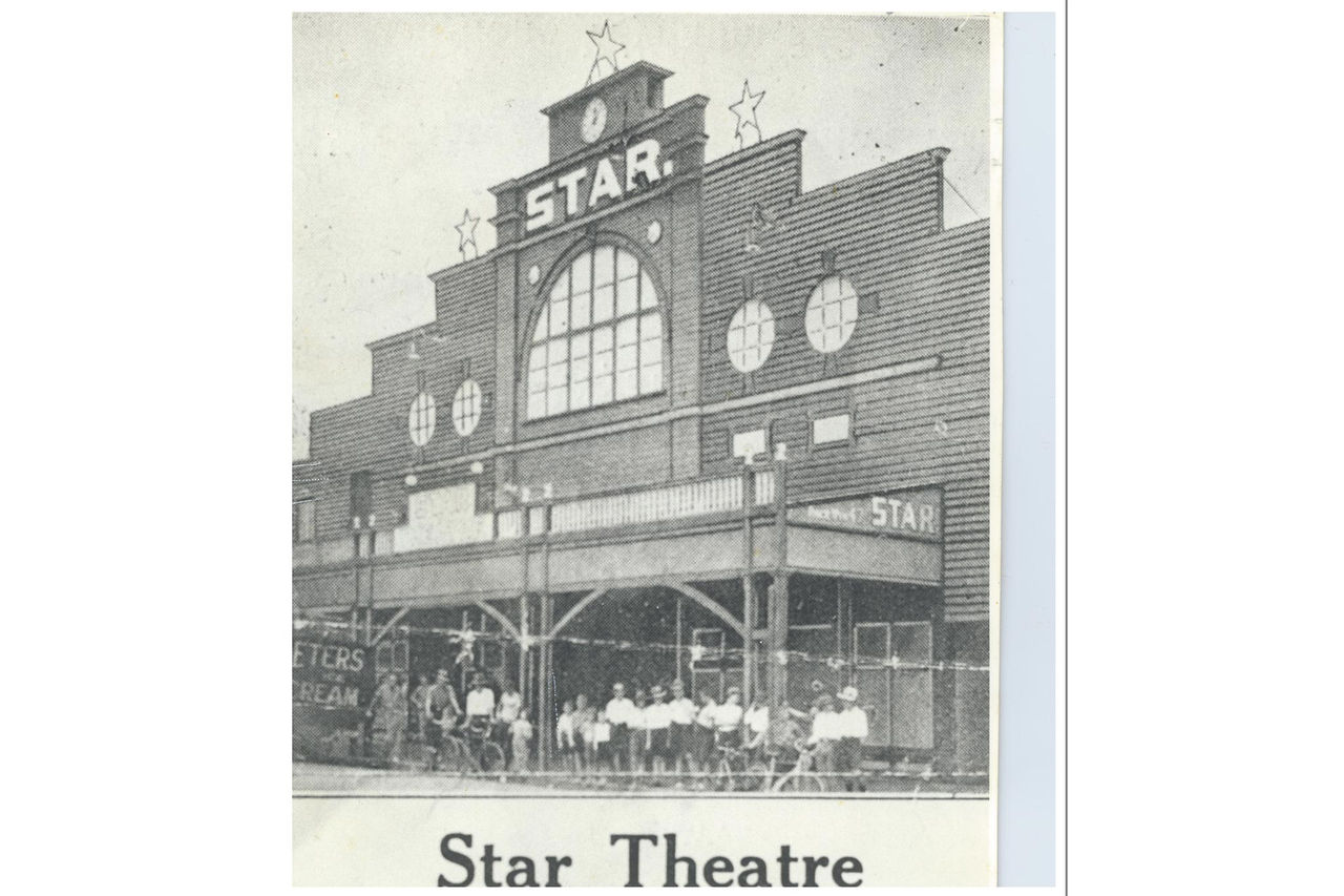
Star Picture Theatre, Wynnum, c. 1940s (Brisbane City Archives)
Its popularity made it a significant social hub during the early 20th Century. Notable national figures, including Prime Ministers Billy Hughes and Jim Scullin, addressed large audiences here. The building was destroyed by fire in 1959, resulting in the tragic loss of 2 firemen. A plaque on Florence Street now commemorates their service and the site’s cultural history.
105 Florence Street, Wynnum
Get directions
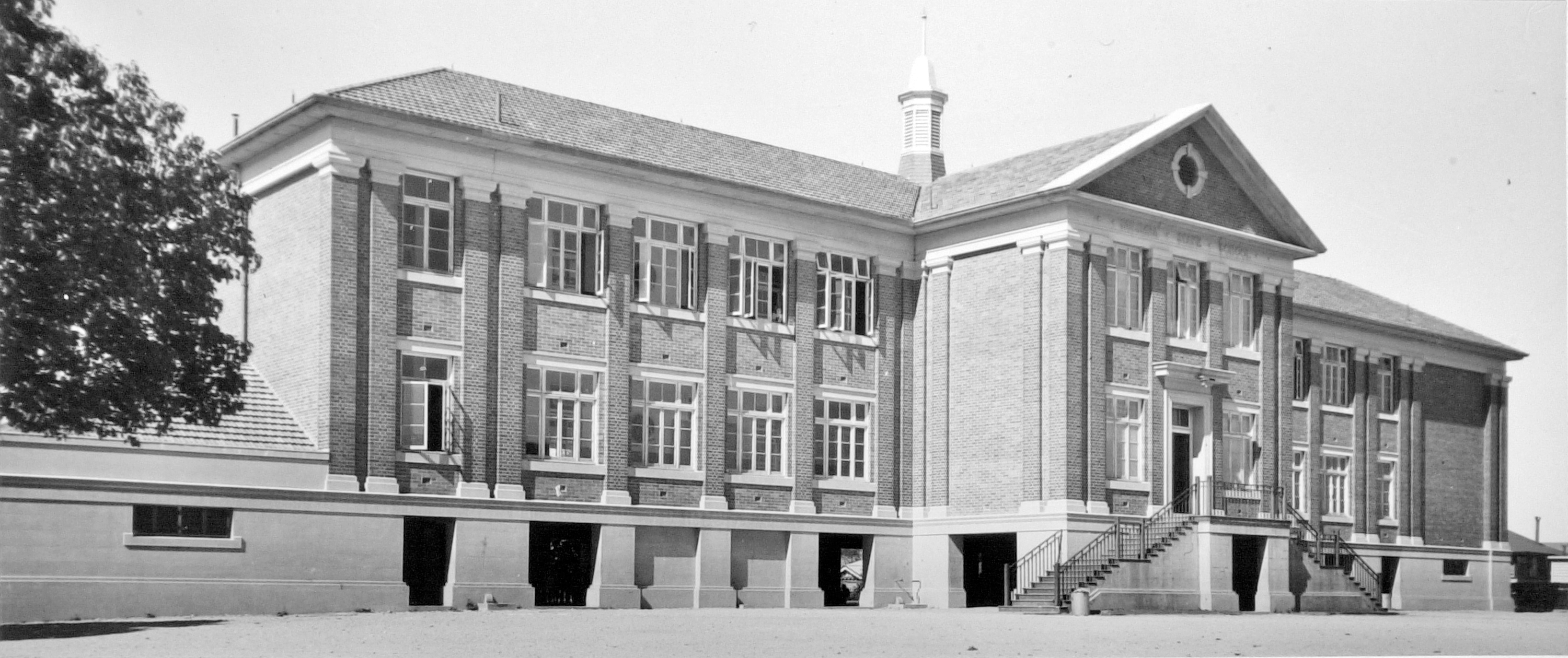
Wynnum Central State School, Wynnum, 1952 (Queensland State Archives)
It was renamed Wynnum Central State School in 1910. As enrolments grew, new buildings were added, including this modern Georgian Revival structure completed in 1949. The school served generations of Wynnum families until 2010, when it was relocated after merging with 2 other schools. Today the former campus operates as the Wynnum Community Centre, supporting local programs and activities.
Bay Terrace, Wynnum
Get directions
Looking along Bay Terrace, c. 1935 (State Library of Queensland)
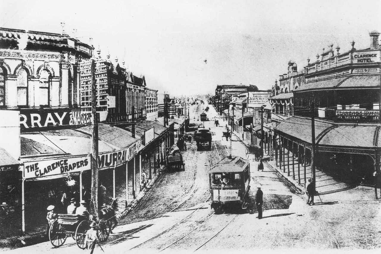
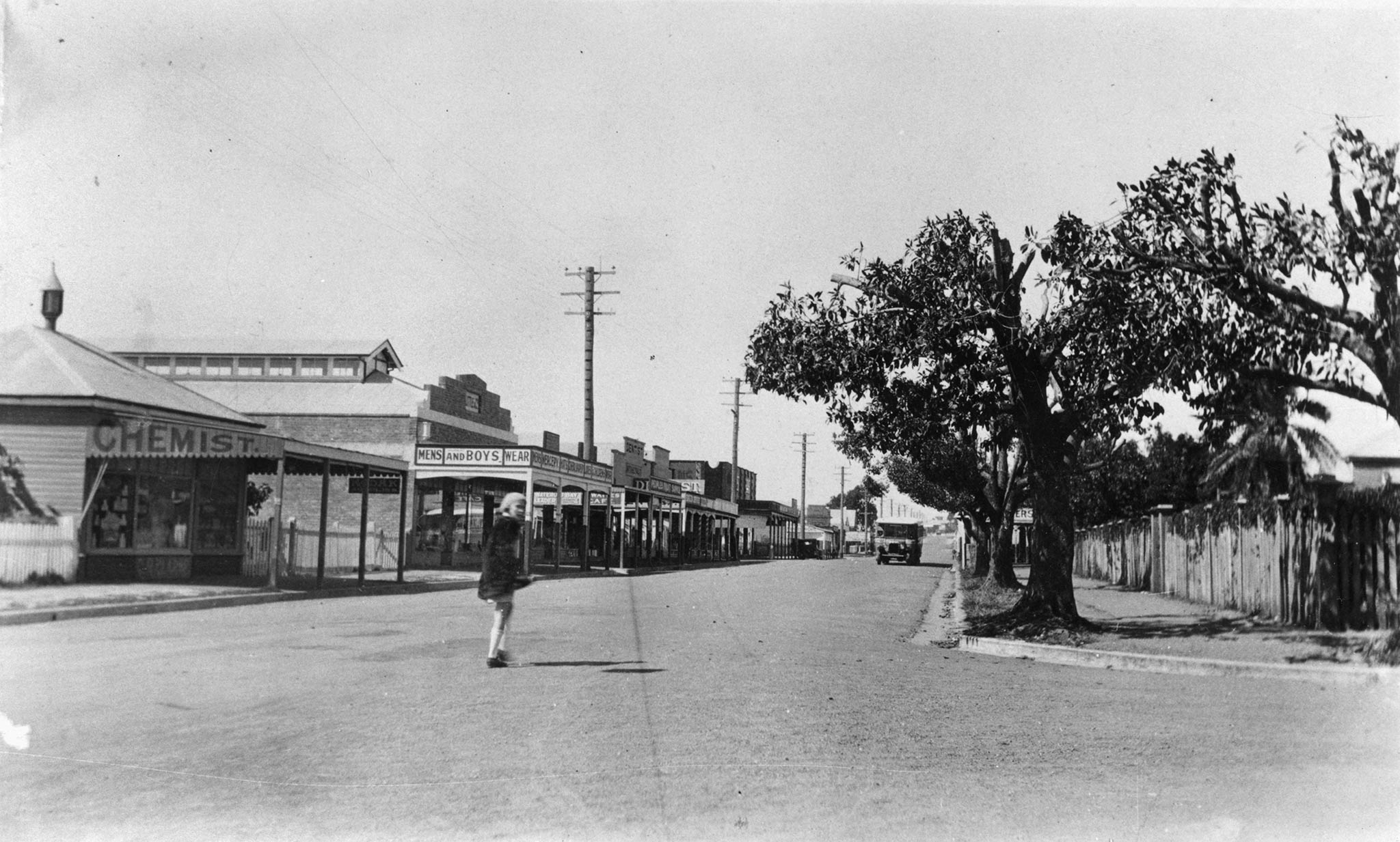
Moreton Bay Girls’ High School once stood on the corner of Charlotte Street. The boarding and day school was founded in 1901 and moved to a larger site in the 1980s. As Wynnum evolved, Bay Terrace continued to adapt, maintaining its role as a central place for business and daily activity. Today it remains a vibrant high street supporting a wide range of shops, restaurants and community services.
155 Bay Terrace, Wynnum
Get directions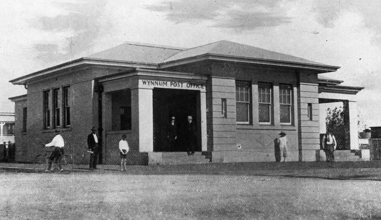
Wynnum Post Office, c. 1925 (State Library of Queensland)
The new post office opened in 1924 with dedicated spaces for mail sorting, telephone exchange operations and staff facilities. It quickly became a central point for daily life, handling correspondence, telegrams and telephone calls for residents and businesses. A separate automatic telephone exchange was added across the road in 1955. After closing in 1995, the building was repurposed for private commercial use.
198 Bay Terrace, Wynnum
Get directions
Guardian Angels Catholic Church, Wynnum, 1910 (State Library of Queensland)
Designed in the Federation Carpenter Gothic style and built from local hardwood, the church could hold up to 400 people. Its elevated position offered views over Moreton Bay, making it a notable local landmark. A parish school followed in 1914, providing education on the same site. Today, both the church and school continue to support the local Catholic community.
199 Bay Terrace, Wynnum
Get directions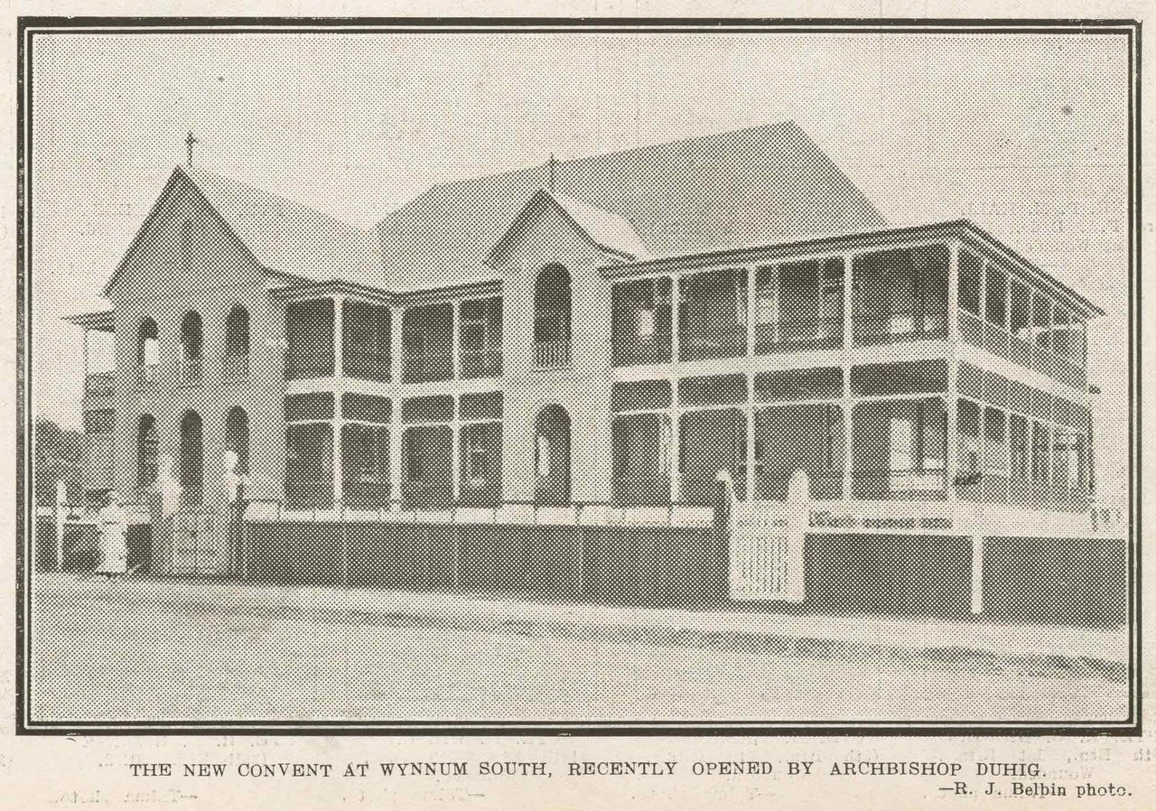
Our Lady of Mt Carmel Convent, pictured in The Queenslander Pictorial, 1915 (State Library of Queensland)
Designed by respected architectural firm Hall and Dods, the 2‑storey brick building became home to the sisters who taught nearby. Over time, the convent evolved to meet community needs, later operating as Mt Carmel College from 1957 to 1992. After a restoration completed in 2014, the building was purchased by Brisbane Catholic Education. It continues to support local Catholic schooling and community life.
33 Tingal Road, Wynnum
Get directions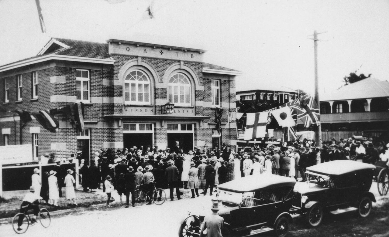
Opening day at the Wynnum Ambulance Centre in Tingal Road, 1926 (State Library of Queensland)
As community demand grew, a Wynnum subcentre opened in 1918, operating from a small cottage on the same site. Its location near the railway and town centre allowed quicker responses and easier transfers to Brisbane hospitals. The service continued to expand adding vehicles and equipment to support the growing population. In 1927, a purpose‑built ambulance station opened after strong community fundraising efforts. The station served Wynnum until 1996 and now operates as the Wynnum Ambulance Heritage Museum.
221 Bay Terrace, Wynnum
Get directions
Workers outside the Wynnum School of Arts, 1913 (State Library of Queensland)
It quickly became a cultural centre for the district, hosting dances, concerts, public meetings and exhibitions. In 1915, it also accommodated the first Wynnum Manly Show, which attracted thousands of visitors. Over the decades, the building adapted to community needs and later became a public library. Since 1977, it has operated as a community hall, continuing to provide space for classes, activities and local gatherings.
Overlooking Moreton Bay from Cedar Street, Wynnum
Get directions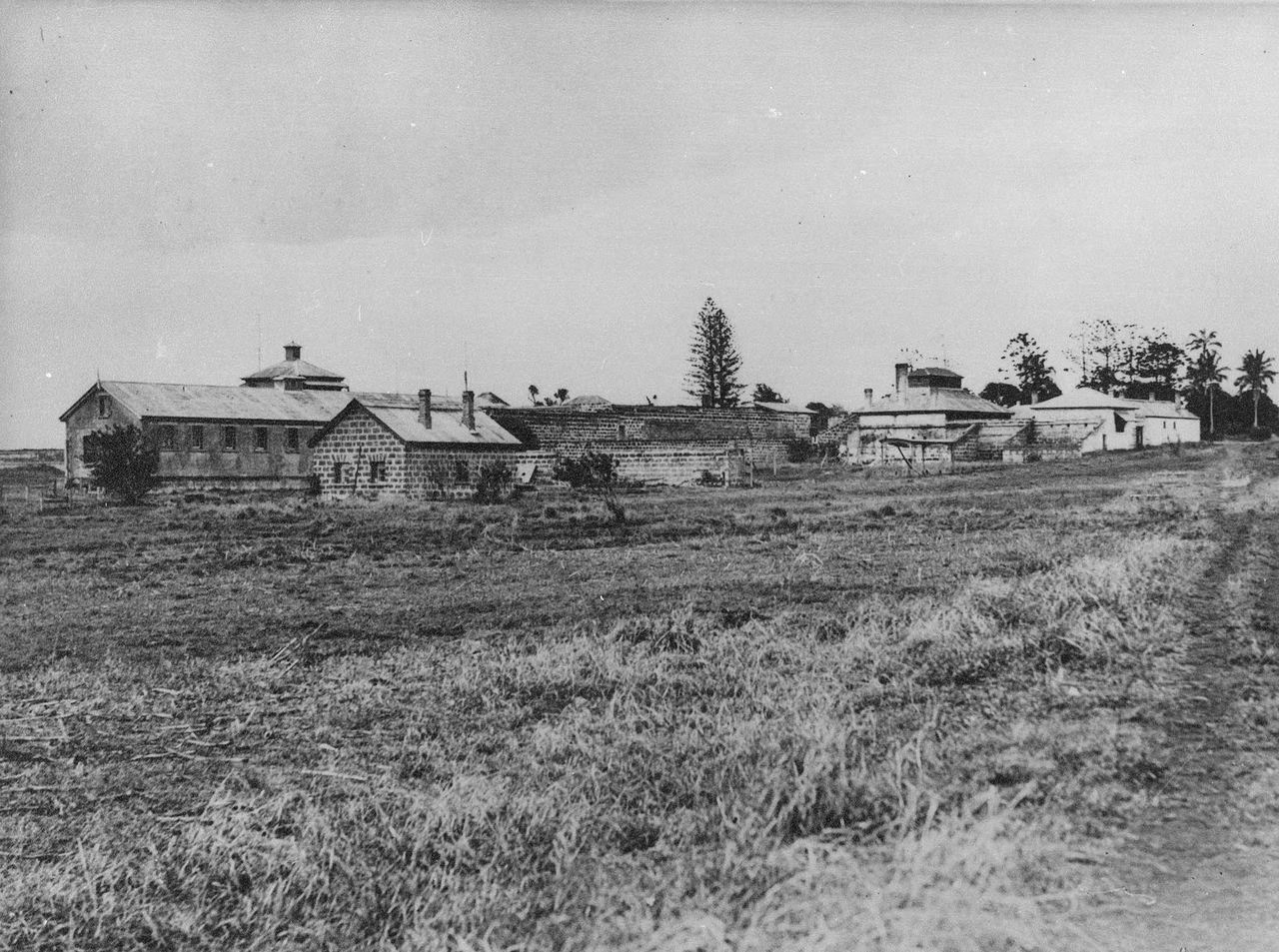
Prison buildings at St Helena Island, Moreton Bay, c.1928 (State Library of Queensland)
Harsh conditions earned it a grim reputation, yet its natural beauty gradually drew public attention. After the prison closed in 1933, the island became a tourist destination with leisure facilities and regular ferry services. Green Island also became a popular destination for day trips and camping holidays. In 1917, picnic shelters and boating facilities were created by local sailing groups.
Wynnum Esplanade, Wynnum (near Pine Street)
Get directions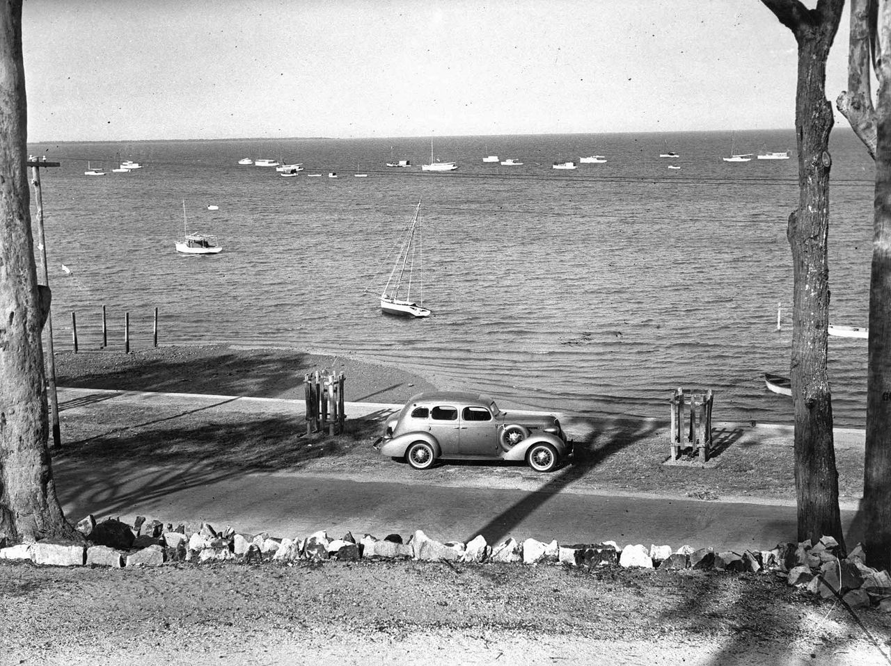
Looking over the Wynnum Esplanade to boats in the bay, 1936 (State Library of Queensland)
During the 1930s, major upgrades were carried out as part of large public works programs. The wall was strengthened with stone and reinforced concrete, making it more resilient against tides and storms. Additional slipways were added to support boat maintenance and recreation. Much of the stone used came from a former Council quarry at Lytton. This helped reduce construction costs and allow further investment in pathways, landscaping and public seating.
Wynnum Esplanade, Wynnum
Get directions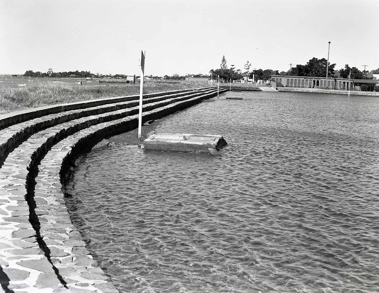
Wynnum Wading Pool, c. 1946 (Brisbane City Archives)
Valves were added to keep marine creatures out and to retain water during low tide. When the pool opened, a week‑long community festival celebrated the new foreshore attractions, drawing more than 8,000 visitors. Nearby, a memorial to Walter Henry Barnes was added in 1934. The stone monument honours his long public service and strong support for community wellbeing.
Wynnum Esplanade, Wynnum
Get directions
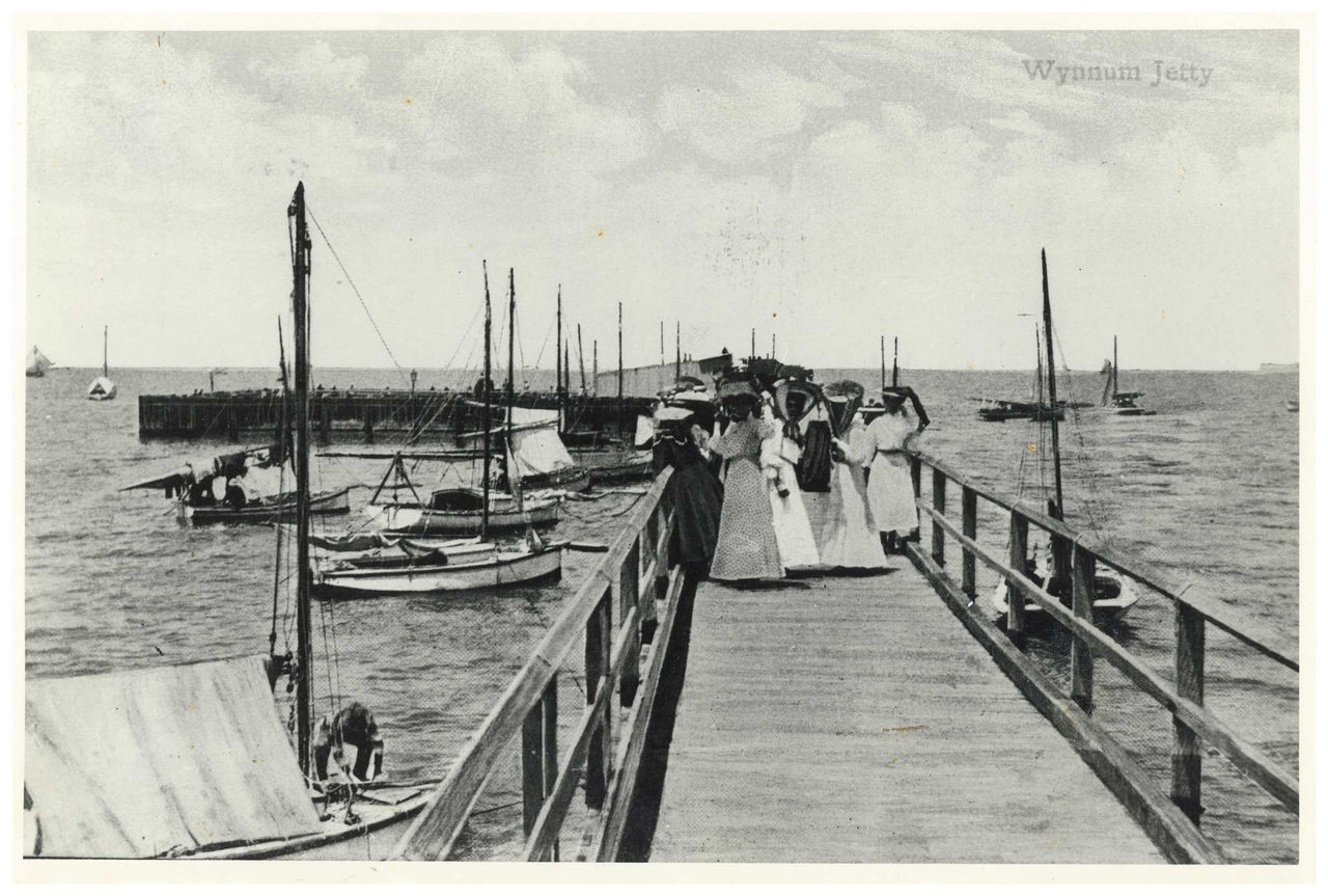
Ladies taking a stroll on the Wynnum Jetty, 1905 (Brisbane City Archives)
Over the years, visitors used bathing boxes, showers and lights installed by Council to improve comfort and access. Storm damage from the 1954 cyclone led to the jetty being replaced, with the modern structure seen today. ‘T Jetty’, as it’s known locally, remains one of Wynnum’s most recognisable foreshore landmarks, offering long views across Moreton Bay.
Wynnum Jetty gallery
Words supplied by Aunty Becky, Winnam Aboriginal and Torres Strait Islanders Corporation
Wynnum Jetty
"The three pylons at the entrance (designed by local resident, Paul Songhurst) represent the past, present and future. The Aboriginal murals along the walkway express the wisdom of Aboriginal Elders and people who combine the knowledge of nature and the behaviour of land and sea animals to gather food. For example, when lorikeets are plentiful, it indicates a good season for sea mullet."
Extension - Wynnum Manly Foreshore Trail
This 2.6 kilometre heritage trail features 9 points of interest.
The route begins at Oyster Point and Wynnum Creek, Wynnum and ends at Norfolk Point and Manly Beach.
Trail map
Point of interest
Opposite 25 Waterloo Esplanade, Wynnum
Get directions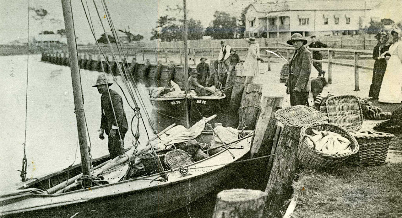
Unloading fish at Wynnum Creek, 1907 (Brisbane City Archives)
The enclosure was removed in the 1960s. Fishing was considered Wynnum’s most important industry, anchored by the State Fish Market’s receiving depot built here in 1917. The depot enabled quick unloading, cleaning and icing of catches for transport to Brisbane. It was part of a government scheme to help keep the cost of household stables like fish, meat and sugar low. From here, you can sometimes glimpse the Fox Street bridge through the mangroves. An earlier bridge, built in 1899, was timber and later replaced in 1921.
Oyster Point and Wynnum Creek gallery
Words supplied by Aunty Becky, Winnam Aboriginal and Torres Strait Islanders Corporation
Oyster Point and Wynnum Creek
"Many places along the foreshore were a meeting place for Aboriginal people. The area from Greene Park to Elanora Park ("by the water" in Aboriginal language) used to be known as Blacks camp among Wynnum locals. Big corroborees were often held there as well as in Manly (on the site of Manly Hotel)."
Breakwater Park (site for Sorry Day)
"Since 1998 the community members get together on National Sorry Day on 26 of May every year. Commemoration and Remembrance Ceremony to acknowledge the history of First Nations People, the hurt and sorrow of the Stolen Generation and their families. The children of the Stolen Generations are still finding the way to reconnect with their family to this day."
75 Waterloo Esplanade, Wynnum
Get directions
Home of Engineers Harvey Sergeant & Co., Iron Foundry on Alice Street, c. 1887 (State Library of Queensland)
The family’s success allowed them to enjoy seaside living while commuting by rail to the city. The company also worked on marine projects, repairing and upgrading racing boats used by the Wynnum and Manly Sailing Club. Britannia remained in the Sargeant family until the late 1970s and continues to serve as a private residence.
Wynnum Esplanade, between Charlotte and Florence streets
Get directions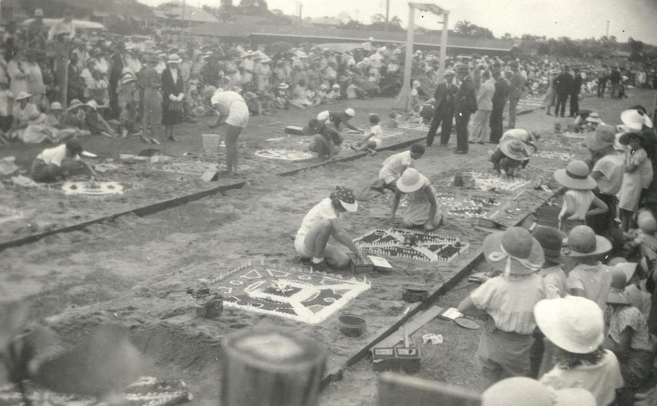
Sand garden competition at Pandanus Beach and the nearby parkland, 1933 (Brisbane City Archives)
The small beach became popular for picnics and for watching sailing races across the bay. By the 1930s, it even hosted large community events, including a sand‑sculpting competition that attracted thousands. As visitor numbers grew, Council expanded the beach using sand from Stradbroke Island, opening the new Pandanus Beach in 1987.
Wynnum Esplanade, opposite Florence Street
Get directions
Ladies taking a stroll on the Wynnum Jetty, 1905 (Brisbane City Archives)
The jetty also became a prime location for watching boat races that attracted large audiences. In 1924, boats with colourful flags launched from the jetty to celebrate the new Centenary Motor Boat Club. A concrete pontoon was added in 1925. It gave small boats access to the shore while keeping the deeper water clear for swimming.
Wynnum Jetty gallery
Words supplied by Aunty Becky, Winnam Aboriginal and Torres Strait Islanders Corporation
Wynnum Jetty
"The three pylons at the entrance (designed by local resident, Paul Songhurst) represent the past, present and future. The Aboriginal murals along the walkway express the wisdom of Aboriginal Elders and people who combine the knowledge of nature and the behaviour of land and sea animals to gather food. For example, when lorikeets are plentiful, it indicates a good season for sea mullet."
Wynnum Esplanade, opposite Edith Street
Get directions
Wynnum Wading Pool, c. 1946 (Brisbane City Archives)
Floodlights were installed in 1934, allowing evening swimming and attracting large crowds for community celebrations. Over the years, the pool became a popular venue for model yacht races and holiday gatherings. It remains one of Wynnum’s most visited foreshore attractions.
Foreshore between Wynnum Jetty and Darling Point
Get directions
Camping grounds at Wynnum, c. 1910 (Brisbane City Archives)
In 1926, the Wynnum South Progress Association asked City Planner William John Earle to design a long‑term improvement plan. His vision included a wide footpath, shady trees, generous seating and new recreation spaces. These upgrades helped transform the foreshore into a lively public area. During the early 1930s, new parks created along the sea wall became popular venues for community events. The area was perfect for carnivals that attracted large crowds and supported local fundraising efforts.
83 Lower Esplanade, Manly
Get directions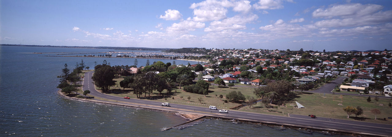
Aerial view of Darling Point, 1993 (Brisbane City Archives)
By the 1930s and 1940s, Darling Point was a favourite holiday camping area. The campsites were kept open for an extended season and new amenities added, including electric lighting and water. Sailing clubs also flourished, and the point became a key location for junior racing and local regattas. Today, it remains a scenic spot for enjoying views across Moreton Bay.
Opposite 365 Esplanade, Manly
Get directions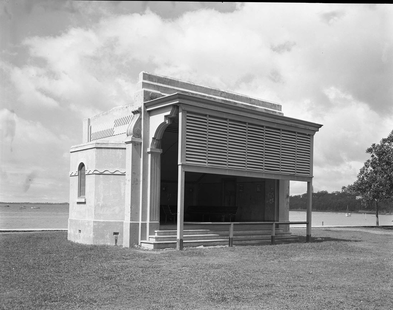
Orchestra shell on the foreshore, 1952 (Brisbane City Archives)
Bathing boxes were installed along the Esplanade in 1929, offering convenient places for swimmers to change. The foreshore also became a lively entertainment space, with regular sailing events and community gatherings. A shell‑back style bandstand was added in 1935, projecting music across the waterfront until its removal in the 1960s.
450 Esplanade, Manly
Get directions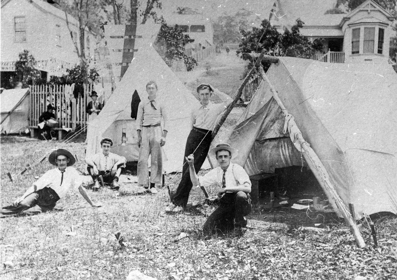
Campers on Manly Beach, c. 1920s (Brisbane City Archives)
In 1929, a new concrete bathing pool was added. It offered hot and cold seawater showers, lighting for night swimming and equipment hire. The pool refilled with each high tide and fully drained at low tide. As boating expanded across Queensland, a protected harbour became essential. Norfolk Point was built in 1958, shielding the harbour from waves and named after Lieutenant Matthew Flinders’ vessel Norfolk.