Waterway projects

Link copied

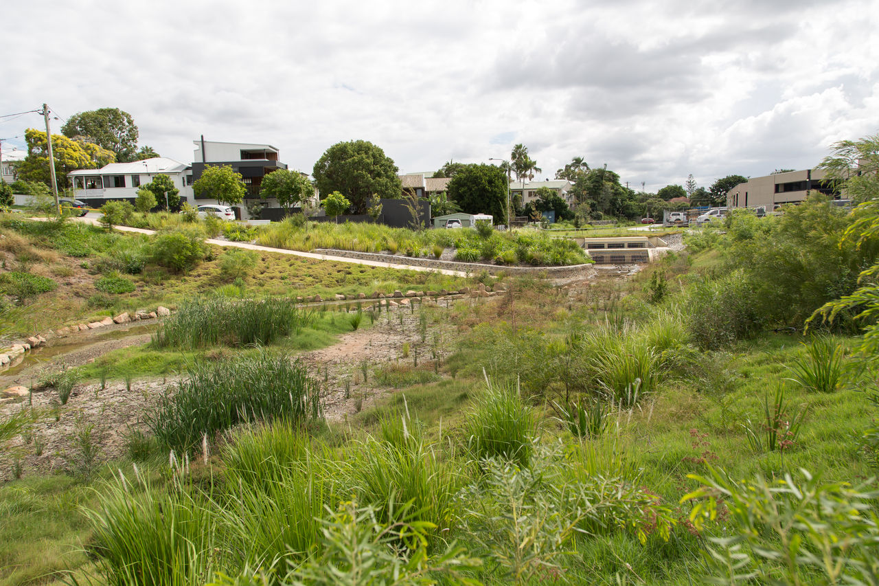
Find out how our creek and waterway projects, like Kedron Brook Revitalisation, are supporting local wildlife and our city’s great outdoor lifestyle.

About creek and waterway projects

Our projects support the health of our local creeks and waterways, the Brisbane River and Moreton Bay. 

We want to protect these natural assets, which are a vital part of our environment, local economy and our daily lives.

Keeping waterways healthy will help: 

  • create liveable suburbs
  • support and strengthen local biodiversity.
     

Our creek and waterway projects are part of our wider WaterSmart Strategy to improve the health of waterways. This strategy supports Brisbane’s liveability with a focus on sustainable water management.

The strategy includes:

  • practising water sensitive urban design
  • regional and international partnerships:
    • Urban Utilities
    • Council of Mayors Resilient Rivers Initiative
    • International River Foundation
  • implementation of waterway health rehabilitation programs and natural channel design
  • ecosystem health monitoring programs
  • partnering with catchment groups through Creek Catchment Program
  • checks to minimise sediment runoff from building sites.
     

Download Brisbane’s Total Watercycle Management Plan to learn about how we're delivering sustainable water management into the future.

Kedron Brook Revitalisation

Kedron Brook is a much-loved destination for many local residents. We want to ensure it continues to be a great place to visit by improving lifestyle outcomes and boosting flood resilience.

We are working on a vision for the Kedron Brook catchment and we want to hear from you before we finalise the vision. The second round of community engagement is now open. 

The Kedron Brook draft vision sets out a plan for the Brook to be a leading lifestyle and recreation corridor with a healthier, more resilient waterway.

The vision looks at ways to:

  • improve connections between key destinations and public transport, making it easier to walk, ride and move through the corridor
  • provide safe, accessible and enjoyable open spaces
  • strengthen the health and flood resilience of the waterway
  • improve wildlife habitat and the natural environment.

We are committed to keeping Brisbane clean and sustainable, and making our city liveable and sustainable for future generations.

You can download the Kedron Brook Revitalisation Draft 20-year Vision and Summary documents.

In this second round of community engagement, we want to hear from residents again. Have your say about the work we've done so far before we finalise the vision.

Community engagement is open Tuesday 11 August to Sunday 6 September 2026.

You can also visit an information kiosk to speak with the project team.

Information kiosk dates and times

Date Time Location
Saturday 15 August 9-11am Hickey Park, Stafford
Sunday 16 August 9-11am Teralba Park, Everton Park
Wednesday 19 August 2.30-4.30pm Kalinga Park, Clayfield
Thursday 20 August 2.30-4.30pm Dash Street Park, Keperra
Saturday 22 August 9-11am Shaw Estate Park, Wavell Heights
Wednesday 26 August 2.30-4.30pm Grinstead Park, Alderley
Saturday 29 August 9-11am Hickey Park, Stafford
Sunday 30 August 2.30-4.30pm Grinstead Park, Alderley
Wednesday 2 September 2.30-4.30pm Shaw Estate Park, Wavell Heights

For more information you can download the:

  • 2024: Catchment planning, prioritisation and technical investigations.
  • Mid 2025: Stage 1 community engagement.
  • Mid-2025 to mid-2026: Prepare draft vision.
  • Mid 2026: Stage 2 community engagement on draft vision.
  • Late 2026: Finalise vision.
  • Next steps: Program planning, partnerships, design and implementation.

Discover other projects in the area.

Our flood strategies and plans ensure that Brisbane residents, businesses and communities are safe, ready and resilient to flooding. Read the strategy and plan documents below. 

More information

For more information about the Kedron Brook Vision, you can:

Norman Creek 

The Norman Creek 2012-2031 Master Plan aims to restore the 30-square-kilometre Norman Creek catchment to a more natural state.

It seeks to bring nature back into the city, re-establish natural processes and reconnect communities with their waterways.

It's Australia's first comprehensive urban water resources management plan and combines existing plans and activities for the area’s future. 

The plan will contribute to creating a water smart community engaged in water issues.  

Norman Creek starts from Toohey Forest and Mount Gravatt, combining 4 distinct waterways heading north to the Brisbane River.

Our key goals are to:

  • maintain the health of those waterways and ecosystems 
  • create sport and recreation opportunities 
  • be resilient during times of flood and drought 
  • strengthen community connections to the catchment. 
     

Download the Norman Creek 2012-2031 to learn more. 

The Norman Creek 2012-2031 Master Plan revealed 3 top opportunities for various locations across the catchment.

  • Increase and connect parkland and waterways. 
  • Increase tree cover and vegetation to build creek habitats. 
  • Reduce the impact of pollution and litter on waterways. 

The program has already achieved some major milestones with benefits you can now enjoy. 

Coorparoo Creek Park provides:

  • a new route between Old Cleveland Road and Barnes Avenue linking it to Coorparoo Creek
  • public space for workers and residents
  • local flooding management
  • connections for pedestrians and cyclists.

Hanlon Park / Bur’uda redevelopment provides:

  • 5.2 hectares of urban parkland oasis
  • a rejuvenated waterway, new trees and shrubs to support native wildlife
  • local flooding management
  • a new nature-themed play area.
information outline

We've also added stormwater harvesting technology to parks in Holland Park, Greenslopes, Tarragindi, Coorparoo and Norman Park.

This prevents stormwater from surrounding areas getting into our drainage system and uses it to keep parks lush and green.

The next project taking place is the Kingfisher Creek corridor concept plan. This stage will:

  • upgrade greenspaces in Woolloongabba to Kingfisher Creek 
  • protect the health of the creek and catchment’s ecosystem 
  • provide recreation opportunities 
  • improve the area’s resilience to flooding and drought. 

Community consultation on the concept plan for this stage is now closed. 

The final concept plan has been released to the community, and design activities are currently in progress. Implementation options will be considered, subject to budget constraints.

More information

Contact the project team:

  • phone Council on 07 3403 8888
  • write to: 
    Norman Creek 2012-31 Project team 
    Brisbane City Council 
    GPO Box 1434 
    Brisbane Qld 4001.

Oxley Creek Transformation

The Oxley Creek Transformation will see Oxley Creek become a world-class, green lifestyle and leisure destination. 

We are investing $100 million in this 20-year (2017-2037) project to transform the Oxley Creek corridor from the Brisbane River to Larapinta.

The project will create a significant natural environment and community leisure legacy for Brisbane.  

Our key goals are to:

  • reduce the impact of industry and development on the creek and its surrounds 
  • help the area to cope with floods 
  • create green spaces and multi-use parkland 
  • attract investment 
  • collaborate with different businesses, industries, government and community. 

Warril Parkland, Larapinta

Stage 1 of our nature-based playground with water play and picnic facilities is now open. You can also walk along the lakeside boardwalk and pontoon and enjoy birdwatching near the lake. Future stages of the parkland will improve access to a large lake system located north of the new nature-play area.

Archerfield Wetlands

The Archerfield Wetlands Precinct Plan helped to transform 150 hectares of underutilised green space into a new public parkland that balances environmental and community needs.

Archerfield Wetlands District Park includes:

  • a large adventure play space with water play features
  • a youth hub with basketball court
  • a bookable community hall
  • an event lawn
  • a bush resources garden
  • access to the Archerfield Wetlands Discovery Trail, which offers birdwatching, bushwalking and off-road cycling opportunities. 

Graceville Riverside Parklands

We’re planning new upgrades including a water activity hub, larger pontoon and improved picnic areas.

Download the Graceville Riverside Parklands Precinct Plan to discover more.

Oxley Creek Common

Our investment will enhance and expand this habitat to attract more native fauna species, particularly birds, and support more plant species. 

The Greenway

The Greenway route follows the majority of Oxley Creek Common. It’s becoming one of Brisbane’s most popular walking and cycling trails. Improvements will provide easy access to side trails for bushwalking, birdwatching and cycling networks.

Some sections of the future Greenway have already been delivered. These include the Archerfield Wetlands Discovery Trail at Archerfield Wetlands Parkland and the Sea-eagle Lake Trail at Warril Parkland.

Oxley Creek land corridor 

The Corridor Restoration project aims to improve the environmental health of Oxley Creek and its bordering land corridor.

Local habitat, vegetation and waterway health will all be restored and enhanced for the community to enjoy.

Learn more about the goals and progress of the Corridor Restoration Project.

More information

For more information about the Oxley Creek Transformation project, visit Brisbane Sustainability Agency.

Frequently asked questions

To find out about water quality in Brisbane waterways near you, visit water quality monitoring.  

You can help look after our waterways by making small changes at home and in your community. Reduce waste, avoid using harmful chemicals, pick up litter and use water wisely. 

information outline

Note

Stormwater drains are for rainwater only.

To find tips on looking after your local waterways, go to creeks and catchments.

You can help look after our waterways by making small changes at home and in your community. Reduce waste, avoid using harmful chemicals, pick up litter and use water wisely. 

To find tips on looking after your local waterways, go to creeks and catchments.

Without creek and waterway projects, we could face problems including: 

  • lack of quality of water supply
  • loss of essential seagrass habitat
  • less variety of plants and animals living in our waterways.

Oxley Creek Common, including The Red Shed, is managed by Queensland Government Department of Primary Industries. 

To enquire about Oxley Creek Common, or to hire or book The Red Shed, email dpisim@dpi.qld.gov.au.