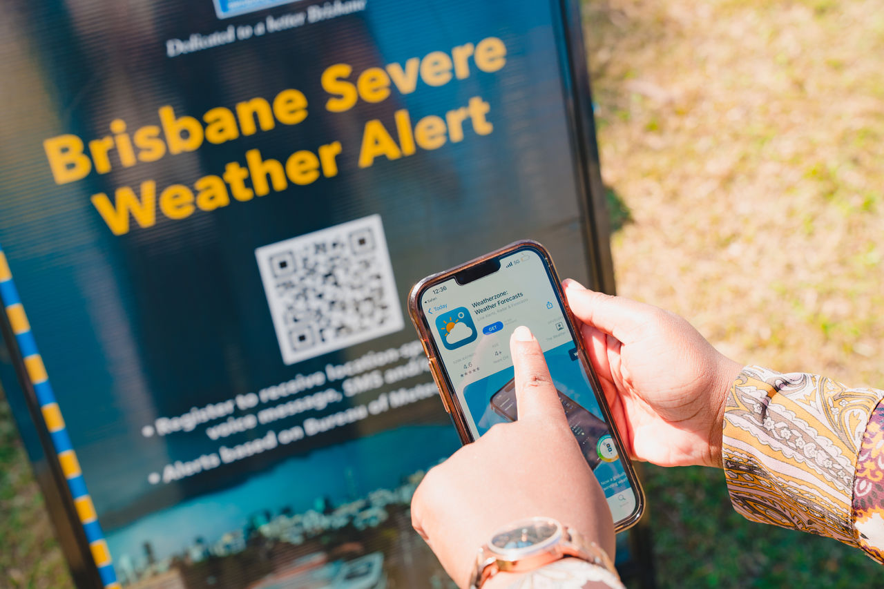
Brisbane Severe Weather Alert

Link copied

Find out how to prepare for storm season by signing up to our Brisbane Severe Weather Alert service and checking creek flooding alerts.

Brisbane's summer can be hot, humid and unpredictable. A fine, sunny day can turn into a heavy, thundering sky at a moment's notice. 

Storm season typically lasts from September to March. During this time, prepare for potential heavy rain, strong winds and other severe weather conditions. 

Subscribe to our alert service

You can prepare for storm season by signing up for our Brisbane Severe Weather Alert service. 

The free service sends you warnings if your nominated address is at risk of severe thunderstorms, destructive winds or potential flooding (including creek flooding alerts). 

Nominate an unlimited number of Brisbane addresses to receive alerts for your workplace, school, or  friends and family.

You can receive severe weather alerts by SMS, email or voice message. These may appear in your phone as a BoM Update.

Remember to verify your email address to complete the subscription process.

Before you subscribe, read the Brisbane Severe Weather Alert terms and conditions.

information outline

Note

You can also view current weather warnings on the Bureau of Meteorology website.  

Creek flooding alerts

The Brisbane Severe Weather Alert service sends creek flood alerts in select locations at risk of creek flooding.

These alerts use information from flood gauges to trigger automatic warnings when waters rise to a certain level due to heavy rainfall, storms or tidal flooding.

It's common for creek alerts to be triggered when creek levels rise and fall quickly in heavy rainfall events or storms.

The service also includes specific river flood alerts in select locations along the Brisbane River. This includes alerts for flooded bridges in isolated communities in: 

  • Karana Downs
  • Kholo
  • Lake Manchester
  • Mount Crosby.

Use the map to view the creek flooding alert locations

Search by address using the search bar.

Click on a location for information on local flooding and the suburbs affected. 

Map legend

Grey: These areas are the first to receive alerts in flash flooding or tidal flooding events.

Purple: These areas receive creek flood alerts in larger scale flood events. 

Blue: These are areas receive alerts for river flooding when bridges and crossings are likely to flood. 

Red: These areas receive alerts if the Brisbane River floods.

Catchment
(or sub-catchment)
Alert area and telemetry gauge Suburbs
Blunder Creek
  • Greater Durack area
View the latest river heights for Blunder Creek at King Avenue
 
Durack, Inala, Willawong
Catchment
(or sub-catchment)
Alert area and telemetry gauge Suburbs
Breakfast Creek
  • Greater Albion, Windsor area 
  • Albany Street Windsor

View the latest river heights for Breakfast Creek at Bowen Hills Rail

Windsor, Newstead and Albion
Catchment
(or sub-catchment)
Alert area and telemetry gauge Suburbs
Breakfast Creek
  • Greater Herston, Windsor area 
  • Northey Street Windsor 
View the latest river heights for Breakfast Creek at Bowen Hills Rail 
 
Herston, Wilston, Windsor
Catchment
(or sub-catchment)
Alert area and telemetry gauge Suburbs
Brisbane River
  • Greater Hawthorne, New Farm area
View the latest river heights for the Brisbane River at Hawthorne
 
Hawthorne, New Farm
Catchment
(or sub-catchment)
Alert area and telemetry gauge Suburbs
Brisbane River
  • Greater Brisbane City area
View the latest river heights for the Brisbane River at the City Gauge
 
Brisbane City, Kangaroo Point, South Bank
Catchment
(or sub-catchment)
Alert area and telemetry gauge Suburbs
Brisbane River
  • Greater St Lucia, Yeronga area
View the latest river heights for the Brisbane River at St Lucia
 
Fairfield, St Lucia, Yeronga
Catchment
(or sub-catchment)
Alert area and telemetry gauge Suburbs
Brisbane River
  • Greater Jindalee area
View the latest river heights for the Brisbane River at Boat Ramp Park
 
Jindalee, Sinnamon Park
Catchment
(or sub-catchment)
Alert area and telemetry gauge Suburbs
Brisbane River
  • Greater Bellbowrie, Moggill area
View the latest river heights for the Brisbane River at Aitchenson Street East
 
Bellbowrie, Moggill
Catchment
(or sub-catchment)
Alert area and telemetry gauge Suburbs

Brisbane River

  • Greater Karana Downs area
  • Colleges Crossing, Mt Crosby Weir Bridge and Mt Crosby Road Bridge (Ugly Gully)

View the latest river heights for the Brisbane river at:

For road conditions and to plan your journey visit Qld Traffic.

Karana Downs, Kholo, Lake Manchester, Mt Crosby
Catchment
(or sub-catchment)
Alert area and telemetry gauge Suburbs

Bulimba Creek

  • Greater Hemmant, Lytton area
  • Doughboy Parade Hemmant
View the latest river heights for Bulimba Creek at Doughboy Parade
 
Hemmant, Lytton
Catchment
(or sub-catchment)
Alert area and telemetry gauge Suburbs
Bulimba Creek
  • Greater Carina Heights, Carindale area
View the latest river heights for Bulimba Creek at Old Cleveland Road 
 
Carina, Carindale
Catchment
(or sub-catchment)
Alert area and telemetry gauge Suburbs
Bulimba Creek
  • Greater Mansfield, Mt Gravatt East area
View the latest river heights for Bulimba Creek at Edwards Park (Merion Place)
 
Mansfield, Mt Gravatt East
Catchment
(or sub-catchment)
Alert area and telemetry gauge Suburbs
Bulimba Creek
  • Greater Upper Mt Gravatt, Wishart area

View the latest river heights for Bulimba Creek at Greenwood Street

Upper Mt Gravatt, Wishart
Catchment
(or sub-catchment)
Alert area and telemetry gauge Suburbs
Cabbage Tree Creek
  • Greater Deagon area
  • Burralong Street Deagon
View the latest river heights for Cabbage Tree Creek at Braun Street
 
Bracken Ridge, Deagon, Sandgate, Taigum
Catchment
(or sub-catchment)
Alert area and telemetry gauge Suburbs
Cabbage Tree Creek
  • Greater Carseldine, Fitzgibbon area

View the latest river heights for Cabbage Tree Creek at Pineapple Street

Aspley, Carseldine, Fitzgibbon
Catchment
(or sub-catchment)
Alert area and telemetry gauge Suburbs
Cabbage Tree Creek
  • Greater Aspley, Bridgeman Downs area

Note: Gauge not installed yet

Bridgeman Downs, Carseldine
Catchment
(or sub-catchment)
Alert area and telemetry gauge Suburbs
Cabbage Tree Creek                 
  • Greater Aspley, McDowall area
View the latest river heights for Cabbage Tree Creek at Old Northern Road
 
Bridgeman Downs, Everton Hills, McDowall
Catchment
(or sub-catchment)
Alert area and telemetry gauge Suburbs
Cannery Creek and Pound Creek
  • Greater Banyo, Northgate, Nundah area
  • Bligh Street Northgate
  • Station Avenue Northgate
View the latest river heights for:
Banyo, Boondall, Northgate, Nundah, Virginia
Catchment
(or sub-catchment)
Alert area and telemetry gauge Suburbs
Downfall Creek
  • Greater Geebung, Virginia area
View the latest river heights for Downfall Creek at Brickyard Road
 
Chermside, Geebung, Virginia
Catchment
(or sub-catchment)
Alert area and telemetry gauge Suburbs
Downfall Creek
  • Greater Chermside West, Stafford Heights area
View the latest river heights for Downfall Creek at Everton Park
 
Chermside West, Everton Park, Stafford Heights
Catchment
(or sub-catchment)
Alert area and telemetry gauge Suburbs
Enoggera Creek
  • Greater Kelvin Grove, Newmarket area
View the latest river heights for Enoggera Creek at Bancroft Park
 
Kelvin Grove, Newmarket
Catchment
(or sub-catchment)
Alert area and telemetry gauge Suburbs
Enoggera Creek
  • Greater The Gap area
View the latest river heights for Enoggera Creek at Royal Parade
 
Ashgrove, The Gap
Catchment
(or sub-catchment)
Alert area and telemetry gauge Suburbs
Ithaca Creek
  • Greater Bardon area
View the latest river heights for Ithaca Creek at Lugg Street
 
Ashgrove, Bardon, Red Hill
Catchment
(or sub-catchment)
Alert area and telemetry gauge Suburbs
Kedron Brook
  • Greater Clayfield, Hendra area
View the latest river heights for Kedron Brook at Nudgee Road
 
Clayfield, Hendra, Nundah
Catchment
(or sub-catchment)
Alert area and telemetry gauge Suburbs
Kedron Brook
  • Greater Gordon Park, Kalinga area
View the latest river heights for Kedron Brook at McCord Street
 
Gordon Park, Kalinga, Kedron
Catchment
(or sub-catchment)
Alert area and telemetry gauge Suburbs
Kedron Brook
  • Greater Everton Park, Mitchelton area
View the latest river heights for Kedron Brook at Osbourne Road
 
Everton Park, Mitchelton
Catchment
(or sub-catchment)
Alert area and telemetry gauge Suburbs
Little Cabbage Tree Creek
  • Greater Aspley, McDowall area
View the latest river height for Little Cabbage Tree Creek at Stringybark Drive
 
Aspley, Bridgeman Downs, McDowall
Catchment
(or sub-catchment)
Alert area and telemetry gauge Suburbs
Lota Creek
  • Greater Ransome, Wakerley area
View the latest river heights for Lota Creek at Rickertt Road
 
Gumdale, Ransome, Wakerley
Catchment
(or sub-catchment)
Alert area and telemetry gauge Suburbs

Moggill Creek

  • Greater Brookfield, Kenmore area
  • Fortrose Street Kenmore
View the latest river heights for Moggill Creek at Fortrose Street
 
Brookfield, Kenmore, Kenmore Hills
Catchment
(or sub-catchment)
Alert area and telemetry gauge Suburbs
Norman Creek
  • Greater East Brisbane, Coorparoo, Woolloongabba area
  • Caswell Street East Brisbane
View the latest river heights for Norman Creek at Caswell Street
 
East Brisbane, Coorparoo, Stones Corner, Woolloongabba
Catchment
(or sub-catchment)
Alert area and telemetry gauge Suburbs
Norman Creek
  • Greater Annerley, Tarragindi area
View the latest river heights for Norman Creek at Ekibin Park South (Arnwood Place)
 
Annerley, Greenslopes, Tarragindi
Catchment
(or sub-catchment)
Alert area and telemetry gauge Suburbs
Norman Creek
  • Greater Holland Park West area
View the latest river heights for Norman Creek at Joachim Street
 
Greenslopes, Holland Park, Holland Park West
Catchment
(or sub-catchment)
Alert area and telemetry gauge Suburbs
Oxley Creek
  • Greater Graceville, Tennyson area
View the latest river heights for the Oxley Creek mouth
 
Corinda, Graceville
Catchment
(or sub-catchment)
Alert area and telemetry gauge Suburbs

Oxley Creek

  • Greater Corinda, Sherwood area
  • Cliveden Avenue Corinda
View the latest river heights for Oxley Creek at Corinda High
 
Corinda, Sherwood
Catchment
(or sub-catchment)
Alert area and telemetry gauge Suburbs
Oxley Creek
  • Greater Archerfield, Willawong area
View the latest river heights for Oxley Creek at Ipswich Motorway
 
Archerfield, Inala, Willawong
Catchment
(or sub-catchment)
Alert area and telemetry gauge Suburbs
Oxley Creek
  • Greater Acacia Ridge area

View the latest river heights for Oxley Creek at Beatty Road

Acacia Ridge, Willawong
Catchment
(or sub-catchment)
Alert area and telemetry gauge Suburbs
Pullen Pullen Creek
  • Greater Pinjarra Hills, Pullenvale area
View the latest river heights for Pullen Pullen Creek at Pinjarra Road
 
Bellbowrie, Pinjarra Hills, Pullenvale
Catchment
(or sub-catchment)
Alert area and telemetry gauge Suburbs
Rocky Waterholes
  • Greater Moorooka, Rocklea, Salisbury area
  • Muriel Avenue Moorooka
View the latest river heights for Rocky Waterholes at Muriel Avenue
 
Moorooka, Rocklea, Salisbury
Catchment
(or sub-catchment)
Alert area and telemetry gauge Suburbs
Rocky Waterholes
  • Greater Coopers Plains, Sunnybank area
View the latest river heights for Stable Swamp Creek at Musgrave Road
 
Archerfield, Coopers Plains, Sunnybank
Catchment
(or sub-catchment)
Alert area and telemetry gauge Suburbs

Stable Swap Creek

  • Boobook Street Rocklea
  • Franklin Street Rocklea
View the latest river heights for Stable Swamp Creek at Marshall Road
 
Archerfield, Rocklea
Catchment
(or sub-catchment)
Alert area and telemetry gauge Suburbs
Wolston Creek
  • Greater Sumner, Wacol area
View the latest river heights for Wolston Creek at Sumner
 
Sumner, Wacol
Catchment
(or sub-catchment)
Alert area and telemetry gauge Suburbs
Wynnum Creek
  • Greater Wynnum area
  • St Catherines Terrace Wynnum
View the latest river heights for Wynnum Creek at Byrneside Street
 
Manly West, Wynnum
Catchment
(or sub-catchment)
Alert area and telemetry gauge Suburbs

Wynnum Creek

  • Greater Wynnum area
  • Tingalpa Street Wynnum West
View the latest river heights for Wynnum Creek at Byrneside Street
 
Wynnum West
Catchment
(or sub-catchment)
Alert area and telemetry gauge Suburbs
Zillman Waterhole
  • Greater Boondall, Virginia area
  • Parthenia Street Boondall
View the latest river heights for Zillman Waterhole at F. Sleeman Park
 
Boondall, Geebung, Virginia